Although we could see the Volcán Cotopaxi from the Quilotoa lake, its bulk and symmetrical cone took on an entirely new dimensions when we followed local advice and picked to experience it within the bounds of its own national park. After a quick overnight in a small on the road hospedaje, with very friendly owners, we picked, as most people do, to enter the park through the Control Caspi on the south entrance.

 According to the very informant guest information centre in the entrance of the park (that is free by the way) Cotopaxi is home to a number of animals like wild horses, llamas, fox, deer, Andean condor and the exceedingly rare spectacled bear. Not that we saw any of the above, but fearless as we are, we did put an effort on climbing to the volcano’s refugio at a height of 4866m (which for us was a record). The rest of the ascent to the top of the peak we left it behind for the fit adventurers and moved on. For our way out though, in order to do something different, we both had the fine idea to take the less used Control Norte as an exit point. That decision didn’t prove to be very wise as the only plus was time added to our arrival in Quito (two hours and bad corrugated road). This optional route wasn’t really worth the effort so we advise you to skip it except if you’re after the local villages.
As you enter Quito in your own vehicle, you definitely get the feeling of a capital city. Dramatically situated high in the Andes, Quito is surrounded by mountain peaks whose greenery is interrupted by gray misty clouds. Modern apartment buildings climb up these slopes 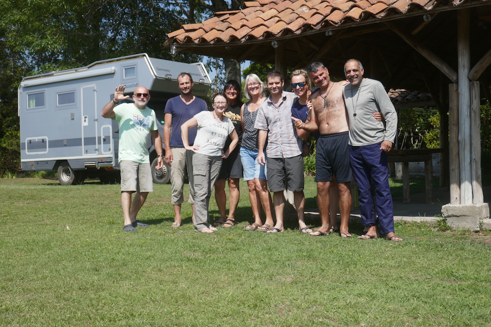
 where busy commercial streets are lined with shops and the traffic that come with them. Somewhere in these chaotic streets, we had to find a solar company in order to repair our solar panels. The bad news about the panels caught up with us in Buena Vista as they were no more charging our battery. We had invested 600$ in these panels and I wasn’t happy to find out that they stopped working. The company we bought them from was willing to replace them but sending them to South America was out of the question. To cut the story short, we managed to replace them with brand new ones for 200$ but we had to compromise on their capacity. It worked for us and we went for it.
In the touristic side of the capital, the city’s highlight and a worth adding on your to do list is the Old Town, a Unesco World Heritage Site, packed with colonial monuments and architectural treasures. There are many hostels that offer free city tours and picking one shouldn’t be difficult. Just make sure you don’t pick Sunday (they do not operate then). Yes, you guessed right, we did pick Sunday. Great coordination, Overlanddiaries!!! Luckily for us though, in the end it all turned out fine as we found Brian, the lonely rider we 
 met in Lima and had our own little city tour that proved to be an equally great experience anyway!!! One more city fix was completed and the next day we took up on the mountains and ended up in Mindo. It’s an eco paradise, with a lovely setting surrounded on all sides by heavily forested mountains. Tiny Mindo has become a popular destination among pensioners looking to retire, as well as backpackers on their way from the coast to the capital. Since we are not retired yet and we are too old to backpack, we had our own good reason for a short stop here: the cloud forest and the humming birds. The area’s magnificent views are interrupted by thick clouds that kick in and turn the scenery into a fairytale setting. The colibris (humming birds in Spanish) are the other reason worth stopping here. Different colours, shapes and sizes of these small creatures are a sight to watch and can keep you busy for hours if you want to take that perfect picture of them. Rochelle can verify this!!! These birds hump and move FAST!!! As a last stop to our Ecuadoran adventure (we will be back here on our way south) we picked the capital of Imbabura province, Ibarra. Our campsite though was a bit out of the city, in nearby Laguna de Yahuarcocha that looks straight up to the Volcán Imbabura, a perfect location really!!!
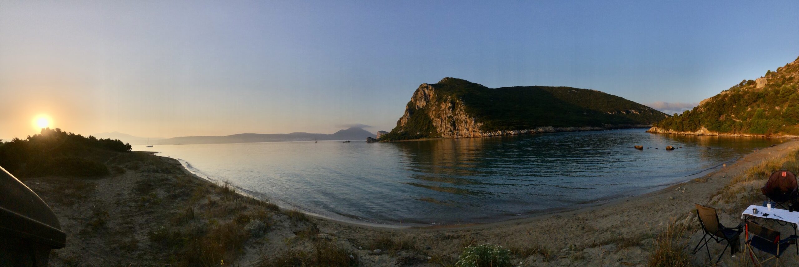
One more border was lying ahead of us and it was the country’s that proved to be my favorite during my last visit here, back in 2004. I was really curious to see how it had changed since then. So without any more delay, welcome to Colombia, the country where the Andean summits, the Caribbean coast and the enigmatic Amazon basin meet. A country that has just exited the longest civil war and now looks at the future straight in the eyes. As soon as we crossed the border, we felt the Colombian hospitality. Locals were happy to talk, to get to know us or just help us anyway they could.
The first city we came across was Ipiales, a border town that besides a nice central plaza has very little to offer. So after buying 
 insurance for Voukefalas and exchanging some money, we headed further out in Las Lajas, where we spent our first free night in the car park of the cable car compound. Las Lajas village owns its fame to the neo-Gothic Santuario de Las Lajas, a church that is built literally ON a stone bridge overlapping the deep gorge, a strange but at the same time spectacular sight. The church was constructed directly against the rocky wall of the gorge, where the image of Mother Mary appeared. A painting of the Virgin has been painted directly on the rocks just to be sure there is no confusion. The best views of the church are found after a short walk to the waterfall, on the far side of the canyon. The next day we pushed through a wonderful route via high mountains and deep gorges till we reached Popayan. This small
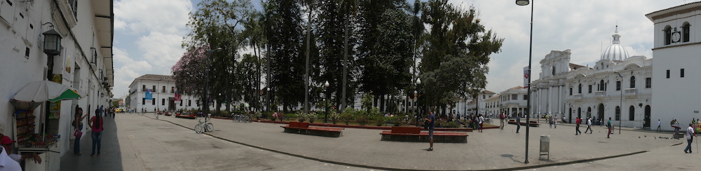
 colonial city is famous for its white facades. Its nickname is La Ciudad Blanca (the White City) and it is second only to Cartagena as Colombia’s most impressive colonial settlement. It sits beneath the Valle de Pubenza and for hundreds of years it was the capital of southern Colombia, before Cali took over. The city feels alive as numerous universities are based here, something that is obvious during the day as the streets of the old centre are filled with students. Walking around was all we needed to do to get under the city’s skin. The highlight of our visit though was not in the city itself but back in our campsite where we met a doctor that happened to stay there. He presented himself as the doctor that goes where other doctors don’t go. His job was to help the local indigenous groups survive and overcome the problems that the young generation faces by dropping their traditions and following the western way of living. Spending a night talking to a person with such knowledge definitely captured our interest for the indigenous groups of Colombia. Influenced by him, we picked our next destination – which was not in our original plans – a picturesque mountain town 53km northeast of Popayán, Silvia, the centre of the Guambiano region. The Misaks (Guambiano people) don’t live in Silvia itself, but in the small mountain villages surrounding it.

Their whole community numbers about 15,000 people and is considered one of the most traditional indigenous groups in Colombia. 
 They speak their own language, dress traditionally and still use traditional farming techniques. They’re excellent weavers and on Tuesday, market day, they come to Silvia to sell fruit, vegetables and their handicrafts. This was the best time to visit the town and so we did. Almost all the Misaks come here dressed in their traditional dress; men in blue skirts and bowler hats, women in hand-woven tops and beaded necklaces. They come in with their chivas (colourful buses) and position themselves in the main plaza. They don’t like cameras and may be offended if you take their picture. Kids though were more than happy to pose for us and so we took advantage of their photogenic figures. The market begins at dawn and goes until early in the afternoon. This is a real market, a place of trade and not a tourist handout.

Next we moved to Cali that, while it may not have the sights to make it in the tourist brochures, is the kind of place that provides all 
 the rest. Here, to our surprise, we were welcomed by a live band that played in our hostel (they were also staying there). It was a special treat and a warm welcome to the city. Now you might wonder why hostel? Well, here we planned to do an undercoating on Voukefalas since the salt had started getting to him, so for the next three days we were homeless. Cali itself now is a hot, big city with a passion for life and cool rhythms. It’s not an easy place to get to know as tourism doesn’t seem to be high in the city’s agenda, but if you’re after great nightlife and good restaurants, especially in the evening, when the cool mountain breeze kicks in, then you are in the right spot. Music here is much more than entertainment; it is a unifying factor that ties the city together. As I read in one of our guidebooks Caleños State: Cali es Cali y lo demás es loma’ . Cali is Cali, and the rest (of the country) is just mountain. With Voukelafas rust free
 and in great shape (thanks to Henry, a great mechanic and his team) we left Cali with direction west and destination Tierradentro, the second most important archaeological site in Colombia. Located well off the beaten track and as we found out down some rough dirt roads, it’s a peaceful place with friendly locals and great archaeological wonders, its elaborate underground tombs. There is a demanding but at the same time fabulous 14km walk you can do (Surprised? Yes, we did it) that takes you in all the major tomb sites that are spread out in the area’s gorgeous mountainous scenery. Check out the footage from our drone in the movies!!!

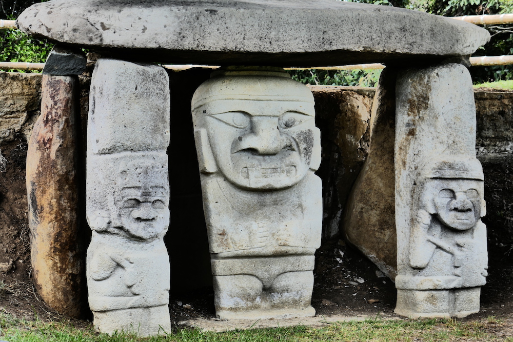
In order to complete the picture on this lost civilization that we know very little about, our next stop was San Agustin, the country’s 
 No1 archaeological site. The story we got from Lonely Planet goes as follows. Five thousand years ago, two indigenous cultures lived in the adjacent river valleys of the Magdalena and the Cauca. Divided by uncrossable peaks, the rivers were their highways. And here, near San Agustín, within several days’ march of each other, lie the headwaters of both rivers. It is here that those two civilizations met to trade, to worship and to bury their dead. While in Tieradentro we visited their tombs. Here we came to visit and admire their centre of worship, where 500 statues (the largest is 7m high) are scattered over a wide area in the green hills surrounding San Agustín. Most of the statues have anthropomorphic figures while others are masked monsters. Archaeologists, as you can read in the small museum in
 the entrance of the site, have uncovered pottery. But except this exhibit, very little are known about the peoples of San Agustín and Tieradentro, as they didn’t have a written language and had disappeared many centuries before the Europeans arrived. With the archaeological park aside, the small village of San Agustin itself and its surrounding hills are an ideal place to relax and do nothing. For the rest of our time here we did exactly that.

Our plan included the challenging route in one of the most isolated sights and the world’s most beautiful river deep in the Colombian Llanos. In order to get there, we had to come across the mountain range called La Serrania de la Macarena. From this mountain a stream originates which later in its journey evolves to become what is commonly known as Caño Cristales, one of the best kept secrets in the world and the world’s most colourful river. I’ll stop here though as the journey to get there is worth being described separately. So stay tuned…[:]